
Remote monitoring
Continued observation of the release without keeping people in position to make it.
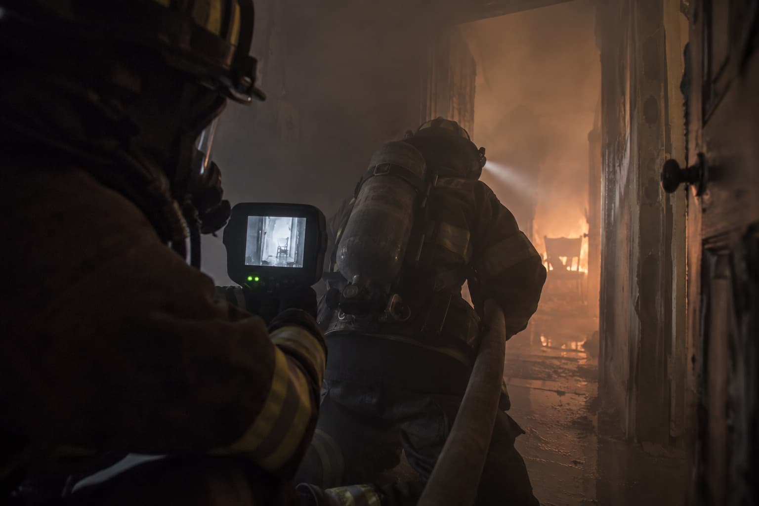
Wind, release rate, product behavior, fire involvement, container condition and responder actions may all change the operational picture. Monitoring must continue after the initial characterization.
Continued observation of the release without keeping people in position to make it.
On-scene wind and conditions, because the regional forecast is not the incident.
Trend over time rather than the single reading taken on arrival.
NOAA and EPA plume modeling. The output follows the inputs and assumptions, and is not an exact prediction.
Flying the scene again to see what has changed rather than assuming it has not.
Redrawing the zones when the wind, the release or the container condition moves.
Modeled dispersion checked against monitoring, so the picture is corrected as conditions change.
Before you buy
Listed alphabetically, not ranked. Everything below is reported by the company itself. Being listed is free and is not a recommendation — use the questions above when you talk to any of them.
FLORIAN
Real-time personnel and resource accountability on a dynamic 3D incident map.
Visit website →MX908
A handheld mass spectrometer that identifies unknown chemicals, narcotics and chemical warfare agents at the scene in seconds.
Visit website →ActiveAlert
ActiveAlert sends emergency alerts to responders and supports mapping, response status, and coordination.
Visit website →Adashi FirstResponse MDT
Adashi FirstResponse MDT gives responders mobile access to incident information for response and scene management.
Visit website →ChemProX
Connected handheld chemical detector providing early warning and classification of chemical warfare agents and toxic industrial chemicals.
Visit website →EXO 8
Drop-and-go connected area monitor capable of detecting up to eight gases plus gamma radiation while streaming readings and location data to the cloud.
Visit website →An in-ear monitor measuring core body temperature, heart rate and fatigue, with alerts and location sent to a live dashboard.
Visit website →Bryx 911
Bryx 911 sends CAD-linked job alerts, routing, hydrant data, responder locations, and team messages to mobile responders.
Visit website →DisasterLAN (DLAN)
Web-based all-hazards incident-management platform providing a common operating picture, GIS, resource tracking, workflows, and ICS documentation.
Visit website →Butterfly iQ3
Smartphone-connected whole-body handheld ultrasound system designed to bring point-of-care imaging to EMS and other mobile clinical environments.
Visit website →Caliber CAD NG
Caliber CAD NG helps 911 centers manage dispatch, mapping, AVL, CAD-to-CAD sharing, notifications, and public safety integrations.
Visit website →Clarius PAL HD3
Wireless dual-array handheld ultrasound system providing whole-body point-of-care imaging and telemedicine capability for EMS clinicians.
Visit website →corpuls3
Modular monitor/defibrillator with ECG, vital-sign monitoring, defibrillation, wireless data transmission, and telemedicine capabilities for prehospital care.
Visit website →D4H Incident Management
Configurable incident-management platform combining maps, status boards, forms, tasks, logs, plans, and responder coordination.
Visit website →Darkhorse Response and Darkhorse Risk
Darkhorse Response Turns incident and response data into insights chiefs use to make faster, more confident decisions. Darkhorse Risk Maps community fire risk using local and national data, revealing hotspots to act on with evidence.
Visit website →Deccan Software Suite
Deccan helps fire and EMS leaders analyze deployment, coverage, move-ups, run cards, and emergency response planning.
Visit website →DroneSense Platform
DroneSense helps public safety agencies fly, manage, map, stream, and collaborate around drone operations.
Visit website →eDispatches detects dispatches and sends alerts to responders through mobile app, text message, or phone call.
Visit website →EmberSat continuously analyzes public satellite imagery to identify likely wildfire ignitions, prioritize them, and deliver operational alerts and mapped intelligence to dispatchers across large, remote areas.
Visit website →ArcGIS
Enterprise GIS and location-intelligence platform for mapping, spatial analysis, field data collection, dashboards, real-time operations, and public safety decision support.
Visit website →ExR-2.5
Certified autonomous inspection robot for potentially explosive industrial environments with LiDAR, cameras, remote operation, autonomous navigation, and configurable sensors.
Visit website →Defensible Space & Home Hardening
Wildfire-resilience inspection software for evaluating properties, delivering mitigation recommendations and measuring community risk-reduction progress.
Visit website →Incident command simulations and training using users own pictures and 3D maps of their locality.
Visit website →Mitigate
Mitigate shows you where fire will go before it starts, which fuel treatments actually reduce that risk and what each costs — and alerts you in real time when something ignites near your values at risk.
Visit website →Flock DFR
Flock DFR is a drone-as-first-responder system that launches drones to provide live incident video and scene awareness.
Visit website →FlowMSP helps fire departments create and access digital pre-incident plans.
Visit website →Sonosite MT
Portable point-of-care ultrasound system designed to deliver diagnostic imaging in mobile and space-constrained care environments.
Visit website →GT5000 Terra
Portable FTIR gas analyzer capable of identifying thousands of gases and simultaneously quantifying multiple compounds in real time.
Visit website →Vscan Air CL
Wireless dual-probe handheld ultrasound that connects to Apple and Android mobile devices for portable point-of-care imaging.
Visit website →Genasys Protect
Zone-based public-warning and emergency-coordination platform for targeted alerts, evacuation information, and interagency situational awareness.
Visit website →GeoComm Indoor Safety
GeoComm Indoor Safety gives fire departments interactive, public-safety-grade indoor maps with searchable rooms, entrances, fire protection systems, and hazards—helping crews preplan, navigate complex buildings, coordinate response, and make faster, safer decisions.
Visit website →DirectSense XM
Modular multi-gas sensing platform supporting toxic gases, VOC/PID, oxygen, environmental measurements, mobile-device connectivity, and cloud monitoring.
Visit website →HAMILTON-T1
Rugged critical-care transport ventilator providing advanced invasive and noninvasive ventilation, monitoring, and connectivity for ground and air medical transport.
Visit website →Hexagon Public Safety Solutions
Hexagon helps EMS and public safety agencies manage dispatch, incident response, pre-planning, collaboration, and operational reporting.
Visit website →MultiRAE Pro
Wireless multi-threat monitor capable of simultaneously detecting chemical hazards and gamma radiation and transmitting alarms to command personnel.
Visit website →IamResponding helps agencies notify responders, track who is responding, view incident information, and coordinate field activity.
Visit website →Ventis Pro5
Connected five-gas monitor capable of transmitting real-time readings, alarms, man-down events, and location information.
Visit website →AwareUS
AwareUS is America’s authoritative emergency information network, powering native mobile apps such as AwareCA with free, agency-led updates for your community.
Visit website →Tiger XT
Handheld PID capable of rapidly detecting hundreds of volatile organic compounds and toxic compounds from ppb to high ppm concentrations.
Visit website →WebEOC Nexus
Cloud-based EOC and incident-management platform for maintaining a common operating picture across agencies and partners.
Visit website →D5 RIID
Compact wearable radioisotope identification device that continuously detects and identifies radiological threats in real time.
Visit website →Mapbox Platform
Developer location platform for building customized maps, navigation, routing, search, geospatial visualization, and location-aware public safety applications.
Visit website →Rad-97
Portable configurable patient monitor supporting pulse oximetry and optional advanced measurements including capnography and noninvasive blood pressure.
Visit website →Capnostream 35
Rugged portable respiratory monitor providing continuous capnography, pulse oximetry, respiratory rate, and integrated respiratory-status assessment for EMS and transport.
Visit website →MIRA DS Advanced
Rugged handheld Raman spectrometer for rapid nondestructive identification of hazardous chemicals, explosives, drugs, and other unknown materials.
Visit website →BeneHeart D60
Rugged transport monitor/defibrillator with advanced patient monitoring and real-time prehospital data transmission capabilities.
Visit website →RDS-32
Rugged handheld radiation survey meter with optional external probes, data logging, wireless monitoring, and mobile connectivity.
Visit website →Command Center CAD Solutions
Motorola Solutions provides CAD systems that help dispatchers process calls, identify units, and send incident data to fire and EMS responders.
Visit website →ALTAIR 5X
Rugged multi-gas detector configurable for combustible gases, oxygen, toxic gases, and PID-based VOC monitoring.
Visit website →AI Co-Pilot Routing Software
Intelligent in-vehicle routing for crews to avoid delays and safety risks while on-route to incidents.
Visit website →OroraTech Wildfire Solution
OroraTech uses satellite data, thermal sensors, AI, alerts, maps, and analytics to detect and monitor wildfires.
Visit website →Pano Rapid Detect
Pano Rapid Detect monitors for wildfire smoke and sends verified incident intelligence to response partners.
Visit website →Perimeter Map
Collaborative incident map for creating and sharing evacuation zones, closures, routes and emergency resources with agencies and the public.
Visit website →Tempus ALS
Lightweight prehospital monitoring and defibrillation system combining the Tempus Pro patient monitor with the Tempus LS-Manual defibrillator.
Visit website →AP4C
Handheld flame-spectrometry detector for continuous detection of chemical warfare agents, toxic industrial chemicals, pharmaceutical-based agents, and other chemical threats.
Visit website →CQL Max-ID
Handheld 1064 nm Raman analyzer for identifying thousands of chemicals, explosives, narcotics, toxic industrial chemicals, and chemical warfare agents.
Visit website →GX-6100
Six-gas sample-draw detector with multiple PID options, toxic sensors, combustible-gas monitoring, oxygen monitoring, and Bluetooth emergency-alert sharing.
Visit website →DEFIGARD Touch 7
Connected emergency monitor/defibrillator offering ECG, capnography, blood pressure, pulse oximetry, CPR feedback, pacing, defibrillation, livestreaming, and ePCR connectivity.
Visit website →SENSIT GOLD 3
Connected multi-gas detector for combustible-gas investigation, toxic-gas monitoring, oxygen measurement, gas-leak pinpointing, and emergency response.
Visit website →Skydio Solution for Fire Service
Skydio provides drones and software for fire service drone-as-first-responder, incident intelligence, thermal imaging, and mapping.
Visit website →BAND V2
An arm-worn monitor that tracks core body temperature, heart rate and exertion, and alerts a safety officer before a firefighter goes down.
Visit website →HazMatID Elite
Rugged handheld FTIR chemical identifier designed for on-scene identification of unknown solids and liquids.
Visit website →Southern Software Public Safety Suite
Southern Software provides CAD, mapping, mobile data, RMS, analytics, and public safety operations tools.
Visit website →4-GasPLUS Sensor Robot
Drone-deployable impact-resistant sensor robot providing four-gas monitoring, 360-degree video, GPS, environmental sensing, and mesh-network communications.
Visit website →StreetWise CADlink Tablet MDT/MDC
StreetWise CADlink gives fire and EMS apparatus a tablet or laptop MDT with dispatch, mapping, AVL, and pre-plan information.
Visit website →Tablet Command helps incident commanders manage units, assignments, maps, accountability, and incident activity from mobile devices.
Visit website →Taurob Operator
ATEX-capable tracked robotic platform for remote inspection, gas detection, spill monitoring, industrial emergency response, and manipulation of valves and equipment.
Visit website →Griffin G510
Person-portable GC/MS system that identifies unknown gases, liquids, and solids at hazardous-material incidents.
Visit website →TruDefender FTX
Rugged handheld FTIR chemical identifier for rapid field analysis of unknown solids and liquids.
Visit website →DustTrak DRX Aerosol Monitor 8534
Portable real-time aerosol monitor that measures particulate concentrations and size fractions for dust, smoke, fumes, mists, and other airborne particulate hazards.
Visit website →Veoci Emergency Management
No-code emergency-management platform for EOC coordination, plans, notifications, workflows, resource tracking, mapping, and after-action reporting.
Visit website →Versaterm CAD
Versaterm CAD helps public safety agencies manage call intake, dispatch, AVL, mobile field updates, and records-connected workflows.
Visit website →Home Safety Assessment
An online walkthrough that helps residents identify fire hazards in their home — from smoke alarms to escape planning — while giving fire departments the data to target education and outreach where it matters most.
Visit website →X Series Advanced
Portable EMS monitor/defibrillator combining advanced patient monitoring, defibrillation, ventilation feedback, telemedicine capabilities, and resuscitation data collection.
Visit website →Something here wrong or out of date? Report inaccurate information · Add a company
Government, standards and peer-reviewed sources on this problem. Every address here was checked before it was published.
The atmospheric dispersion model used to estimate threat zones from a chemical release.
Why it matters
Widely used, free, and worth understanding directly rather than through a product that embeds it.
NOAA's own account of what ALOHA does not model well and where its estimates break down.
Why it matters
ALOHA is a model. Its output depends on the scenario inputs and assumptions you give it, and should never be represented as an exact prediction. Read this before a threat zone drawn on a screen is treated as a fact.
Common questions about inputs, assumptions and interpreting the output.
Why it matters
The practical companion to the limitations page.
Nothing here is paid placement. Links are chosen because they are the clearest explanation we could find, and labeled so you know who wrote them.
Need something that can carry a four-gas meter and survive decon. Our current airframe is not rated for it. What sensor are you carrying, and has it been validated in that configuration rather than on a bench? How are readings transmitted, and at what stand-off distance? How does decon affect the aircraft, and is the platform treated as disposable once it is contaminated? What is your plan if communications fail while it is over the release?